The River Cain joined the SmartRivers programme in autumn 2021. The hub, hosted by Severn Rivers Trust, is using SmartRivers to produce data that will help target local river management and restoration.
The data generated will be a key catalyst in driving action that will help protect the Cain from water quality pressures threatening its capability to support wild fish and other water-dependent wildlife. It will also be used to monitor changes in river health because of restoration efforts made by the Trust and local community groups.
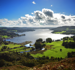
THE RIVER CAIN
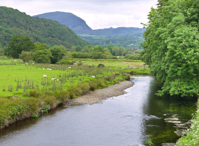
Livestock farming is the most common land use in the catchment. Sheep and stock cattle dominate the upper reaches with a scattering of dairy farming in its lower stages, there are also proposals for intensive chicken units to be built within the catchment. Most of the land through which the river flows is set to permanent pasture, divided by well-established hedges and wooded edges, remnants of which are ancient woodland with steep sided gullies.
The Cain catchment is located on the mid-Wales border and covers an area of 7,916 hectares. It joins the River Vrwyny in Llansantfraid-ym-mechain and continues its journey downstream before joining the River Severn on the border with Shropshire. There are several minor tributaries that drain into the River Cain; alongside rainfall and slope runoff these tributaries are key in determining the rivers water levels and nutrient input.
THE MAIN CHALLENGES
Climate change: The average rainfall for the catchment is 979 mm per year or 77,497,640 m3 per year. This combined with winter storms causes considerable damage to the riverbank sides and already unstable gullies.
- Compaction: Large areas of the surrounding landscape are defined by intensive livestock farming that contributes to increasing pressure from compaction. Infiltration into the soil profile is limited and winter storms result in destructive swells in the rivers flow.
- Habitat degradation: The Cain flows through an upland typography, it is steep sided and gullied. Hedges and woodlands that border its banks have degraded in places creating a landscape that is prone to surface run-off.
- Invasive species: The river Cain is subject to the invasive non-native species of Himalayan Balsam and patches of Japanese Knotweed.
HOW WILL THE SMARTRIVERS HUB SUPPORT CONSERVATION IN THE CAIN?
The Severn Rivers Trust has been working to conserve the River Cain – and reduce the effects of high rainfall events in its upper catchment – since 2014. They work alongside the efforts of the local community to protect and enhance the river.
In conjunction with the Coed Cymru tree planting incentive scheme, the Trust has helped to restore cross slope hedges and fence off areas of woodland to limit the impact of run-off, improving water quality and reducing soil erosion. Riverbank sides have been fenced off and working with local landowners, water troughs and feeding pads have been moved away from water courses.
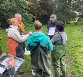
The Cain Valley River Group have supported improvements in water quality by planting trees and hedges to help strengthen the banks of the river and reduce erosion. They have also been instrumental in monitoring and surveying the river and helping to encourage native species and wildlife.
These restorative measures are designed to improve water quality so that the River Cain can support healthy populations of aquatic invertebrate communities and wild fish populations. SmartRivers data will give volunteers on the River Cain the tools by which to monitor and track the success of existing restoration projects. The data will also provide a steer for future management practices as the river adjusts to the unpredictability of changing weather patterns and the increasing pressures from pollution.
Further information
To find out more about becoming a SmartRivers hub and the benefits it can bring to local river restoration projects, and in shaping national water policy, please visit the SmartRivers page or email smartrivers@wildfish.org
By: Dewi Morris
Severn Rivers Trust